 Geobru catalogue
Blue Network
Type of resources
Available actions
Topics
INSPIRE themes
Keywords
Contact for the resource
Provided by
Years
Formats
Representation types
Update frequencies
Service types
Scale
-
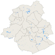
Brussels-Capital Region: the location and name of the ponds in the Brussels Region.
-
Brussels-Capital Region : Location of open rivers bed in the Brussels region. Includes additional information : the name and type (channel, ditch, ...) of hydrological segment.
-

Brussels-Capital Region: typology and codification of all the Unitarian Blue Objects (OBU) - rivers, channel and ponds - of the Brussels Region. We also have the name of the object, the municipality in which it is situated as well as for the rivers, their characteristics (open-air, pertuis)
-
Brussels-Capital Region : the localization of the culvert rivers in the Brussels Region. Includes additional information: the name and type (culvers river, sewer, ...) of the hydrological segment.
-
Brussels-Capital Region: Dataset including the watercourse network, drainage bassin and surface waters of the Brussels capital Region. The dataset is presented as a GML compliant with the requirements of the European INSPIRE directive.
-
Web Map Service for the INSPIRE datasets of Paradigm